PRINTABLE GEOLOGY ATLAS

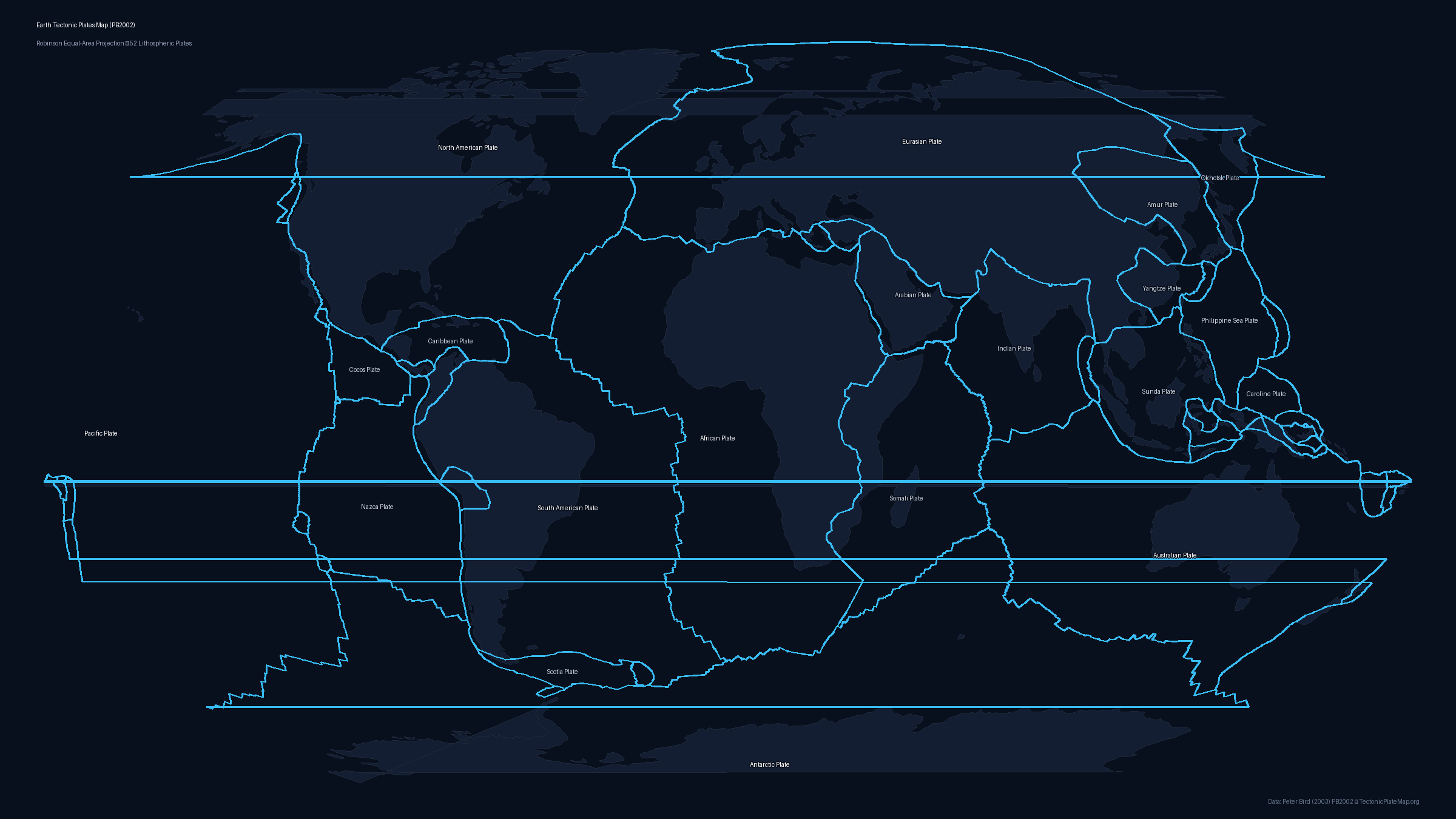
Labeled Tectonic Plates Map

Last updated: October 12, 2026 • Scientific Model: Peter Bird (2003) PB2002
Labeled Tectonic Plates Blank Tectonic Plates Outline Tectonic Plate Boundary by Fault Type Continental Plates & Lithospheric Boundaries
Detailed world map of tectonic plates with names labeled in Robinson projection based on Peter Bird PB2002
Labeled Tectonic Plates Map
Resolution: 2400 × 1350 px • Format: PNG, Vector SVG, PDF

About this Map

The Earth's rigid outer lithosphere is broken into interlocking tectonic plates that float above the ductile asthenosphere. This high-resolution labeled map illustrates the global arrangement of all primary and minor lithospheric plates defined in Peter Bird's peer-reviewed PB2002 geodynamic model. Each major plate—including the colossal Pacific Plate, North American Plate, Eurasian Plate, African Plate, Antarctic Plate, Australian Plate, and South American Plate—is clearly identified alongside key minor plates such as the Nazca, Cocos, Arabian, and Philippine Sea plates. Rendered in the visually balanced Robinson projection, this map minimizes distortion across both equatorial zones and polar margins. Geologists, educators, and students can examine the spatial relationships between continental landmasses and the oceanic spreading centers, subduction trenches, and transform faults that frame them. Both Atlantic-centered and Pacific-centered variants are provided to give complete perspectives on global plate geometry and the circum-Pacific Ring of Fire. You can freely download this map in crystal-clear vector SVG format for digital illustration, 2400-pixel-wide high-resolution PNG for presentations, or print-ready PDF formatted specifically for standard A4 and US Letter paper sizes.

Pacific-Centered Map Variant

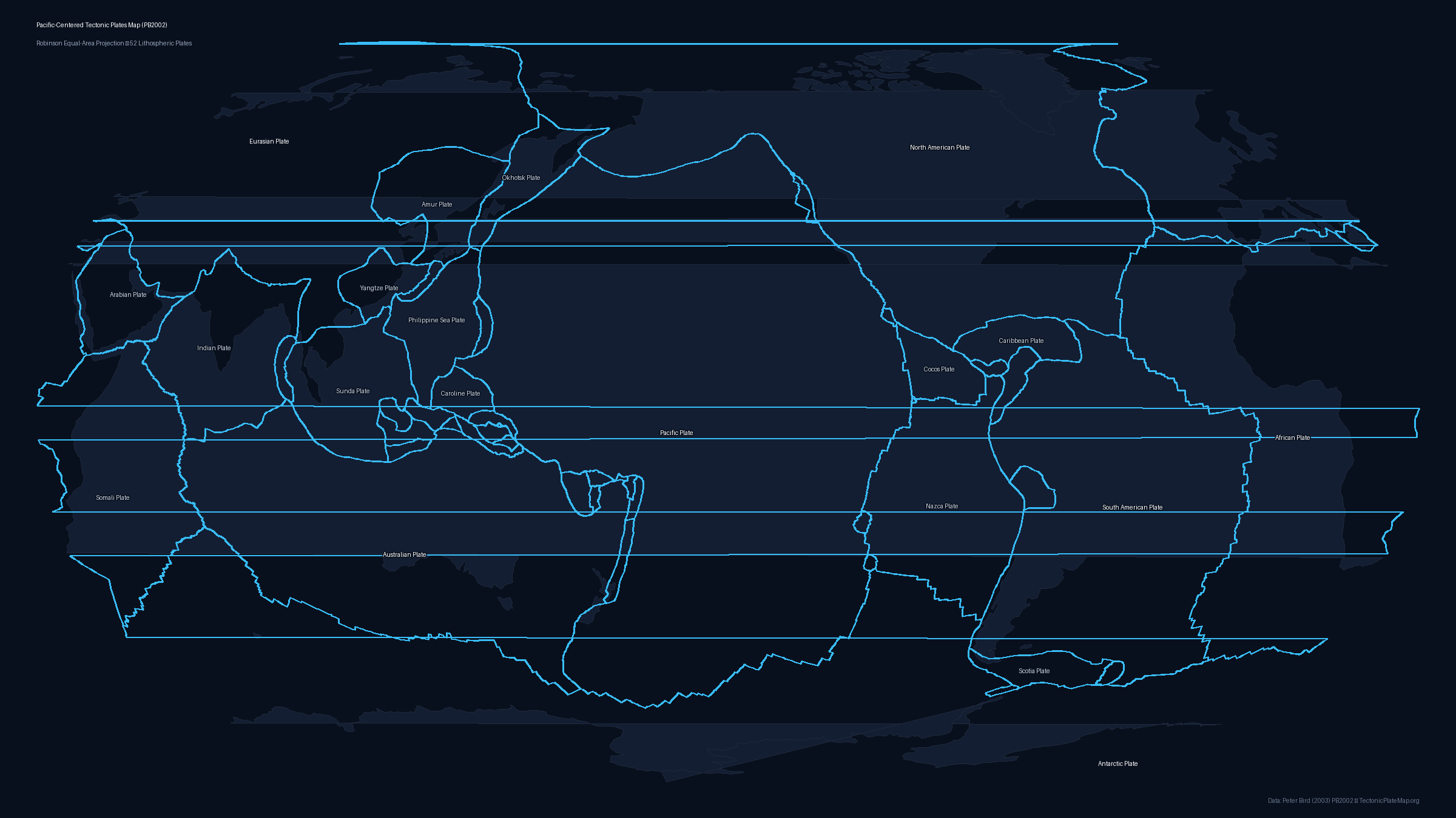
For visualizing the complete Pacific Basin, the Mariana Trench, and the circum-Pacific Ring of Fire without dividing the Pacific Ocean across map edges, use this Pacific-centered projection (centered at 150°W).
Pacific-Centered Tectonic Plates Map Preview

Data Attribution & License

Boundary coordinates, plate geometry, and Euler poles are derived from Peter Bird's seminal work: "An updated digital model of plate boundaries", published in Geochemistry, Geophysics, Geosystems (G³), 2003 (DOI: 10.1029/2001GC000252).

License: The PB2002 dataset is open scientific data available for academic, educational, and public dissemination with attribution. All generated static map files on this page are licensed under Creative Commons Attribution 4.0 International (CC BY 4.0). You may freely use, share, and adapt them for school, research, or publication provided that attribution to PB2002 (Bird 2003) and TectonicPlateMap.org is preserved.